

Integration and Remote Sensing
Home / Geology and Exploration
Helping geologists to identify potential mineral zones, reduce exploration costs, and increase the efficiency and precision of field investigations.
We apply advanced geospatial technologies to support exploration, mapping, and resource evaluation. By combining satellite imagery and GIS-based analysis, we provide precise and cost-effective geological insights that enhance decision-making throughout all stages of mining.
Our main services include:
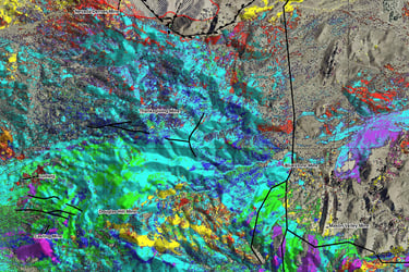
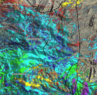
Identifying geological structures, alteration zones, and surface mineralization using high-resolution satellite imagery.
Merging geological, geophysical, and geochemical data into a unified digital platform for analysis and modeling.
Using remote sensing tools to monitor land use, vegetation cover, and environmental impacts around mining sites.
Contact Information
info@neyrizpartco.com
All rights of this website belong to Neyriz Part Mineral Engineering Company.
Working Hours
Saturday - Wednesday ------------------------- 8:00 - 16:00
Next to Refah Kargaran Bank, Valiasr St., Neyriz, Fars, Iran
071-5383-0544
Units and Services
Thursday ---------------------------------------------- 8:00 - 14:00